H ř i v č i c e (Co: Kladno)
50°20´02´´N; 13°55´05´´E; 320 m ASL
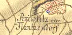
In northwest direction roughly ten kilometers from Klobuky; near the villages of Slavetin and Peruc.
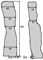
Today this 1,8 m high slender stone stands in the center of the village protected by a low fence.
One can clearly see it was cut in half and cemented again.
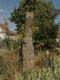
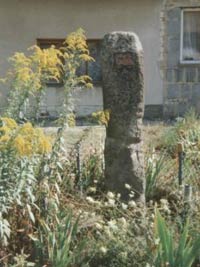
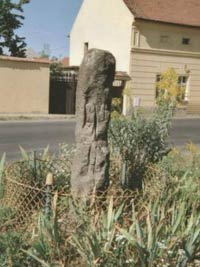
There is a table containing an inscription saying it is serves as a direction indicator from as late as 1680. Neither the author nor the period the table was fitted into the stone is known. In the national list of immovable historical monuments this stone column has been listed as a milestone (information from 1965).
Based on examination of an old map from year 1518 we assume it is really a milestone on the way from Prague to Louny and Cheb.


