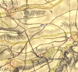
L e d c e near S m e č n o (Co:Kladno)
50°12´40´´N; 14°01´50´´E; 310 m ASL
Ledce - deserted, non-plowed up land; findings dating back to Bronze Age.
Extinguished village called Lhotka just nearby, originally a citadel named Bílý Újezdec back from 1404, in the possession of the gentry from Donín; in 1611 renamed by Martinici to Shtenberk Spa - strongly ferric water.
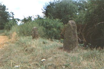
The two stones under their title
Ke dwaum kamenum
(Towards the two stones)
have been marked on the cadastral map made in 1841, and were actually found in 1982 due to terrain verification of the local name.
They are situated on a long flat elevation, on the spot where a field path crosses a deep old hollow way (cutting) about 1km northwest of the church in Přelíc, on the borders betwee cadasters of Řisuty, Ledce and Přelíc.
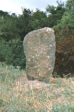

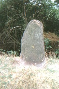
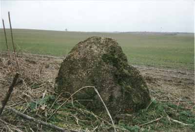
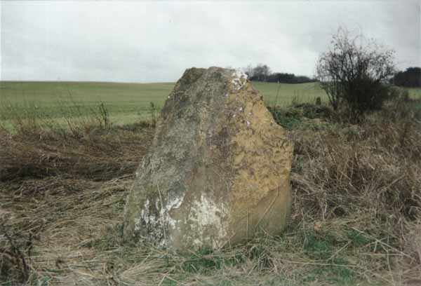
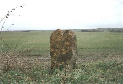
The two stones are made of rusty-brown iron cobblestone 3,5 m away from each other, 0,7 m and 0,8 m high.
On one of the stones concerning its flat side facing the north a cross engraving is quite perceptible. And at about 100 and 150m distance other two stones made of quartzose sandstone 85 and 120 cm high are thought to be lying there (we atually did not investigate).


*Locality downfallen y. 2005


