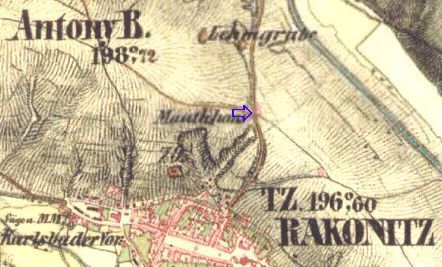
R a k o v n í k
50°7'9.54"N; 13°43'56.67"E; 360 m ASL.
Původní trhová osada na dálkové komunikační trase Cheb, Loket, Bochov a Žlutice a na křižovatce Louny-Plzeň; zmiňován r. 1252; povýšen na město Václavem II. r. 1286; právo opevniti se udělené Jiřím z Poděbrad; 1588 královské město listinou Rudolfa II; Rakovník náležel k panství křivoklátskému; zpustošen za třicetileté války; bitva císařských a královských armád před bitvou bělohorskou; 1788 bylo sídlo do té doby kraje Rakovnického přeloženo do Slaného.
Fewer than 1 km behind Rakovník towards Lišany one can find Kamennou pannu (Stone Virgin) near the ditch on the left side of the road (Na Kokrdech..) This spot is marked in the turist maps.
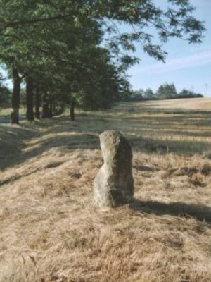
Also this stone has been moved during its life, was taken away at the beginning of the eighties of the 20th century but returned back to its position soon after.
It has been embedded in the ground a bit more and therefore protruding only 60 m high.
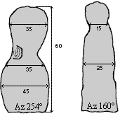
It has been formed by fine-grain sandstone with its surface mouldered rather substantilly.
The study of J. Rennera from 1937 mentions this stone as genuine cross stone. Since this stone has been related with a folk legend about so called "petrified for punishment" we can consider it to be of quite a higher age.


