Stones Rows Within - Kounov Plain
.. continuation ...
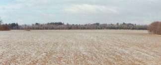
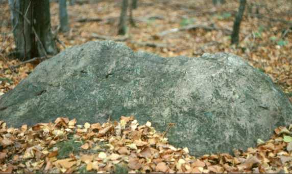
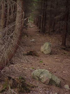
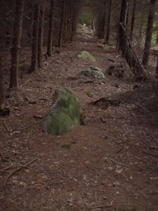
Is see here transit limits and whole peak plains was during that time forested. Today is he without wood growth trees are in the place stone order and above hillslope.
Sowing has been documented through pollen analysis made by Mrs. Vlasta Jankovská, RNDr,,
who discovered among others a substantial habitation of cereal´s pollen grains within samples of top soil.
However when you consider a possibility of creating rows in modern times upon parceling a land then a man with an insight and common sense must doubt it. An idea that a group of poor serfs during their free time would have borrowed some draught cattle and within a substantially long period of time applied exhausting power to harrow out tons of stones on their noodle-like little fields only to make their neighbour know where to plough and where not, seems to look rather like a masochistic degeneration. When delineating their land they just forget to build access roads, and in order not to make it so simple they very carefully put together and align the stones within a previously prepared shallow trench and they do not bother to shovel the soil excavated from this trench on their little field, which is exactly what a farmer would do to gain slightly more fertile land. Instead they shovel it back around the stones. They will use stones of different sizes making their ploughing much more difficult while stealing another strip of land from themselves. When you consider the field length then the area in not negligible at all. A ploughshare pulled by cattle should logically maintain a furrow still by a considerable piece of land further away from the stones with potential for cattle to break their legs. Also unlikely is a version that stones lying over here from immemorial times and causing an obstacle within the field nowadays, get aligned in lines in order to save space. It would be much more convenient to bring them together forming a couple of heaps and throw them from the edges down into the gorges on both sides of Rovina (Plains). It also serves as one of the main reasons that contradicts a theory about tracks built for contesting runners, or even horse contestants. Or only it might be that runners ran to compete who will first end his life down in the bottom of the gorse. We think that this area was never used as a marketplace either. Remaining is the question of an access path, general bad accessibility of this location along with its rather considerable distance from the village. It would had been illogical to ship big amounts of goods up to here. In addition such human activity would leave archeologists with enough material to undergo research work.
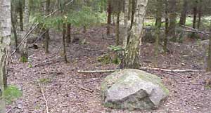
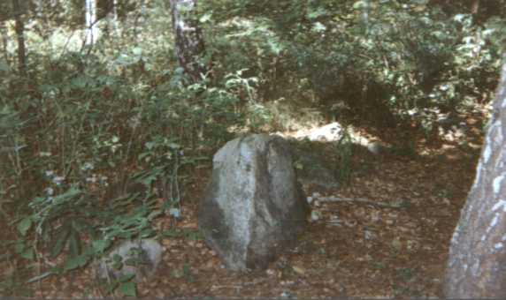
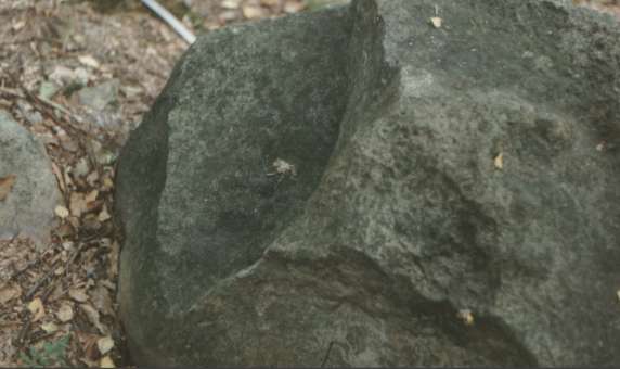
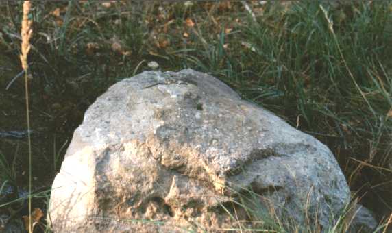
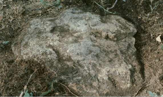
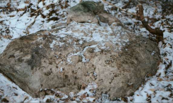
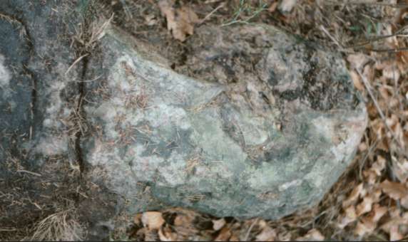
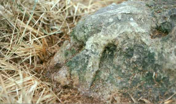
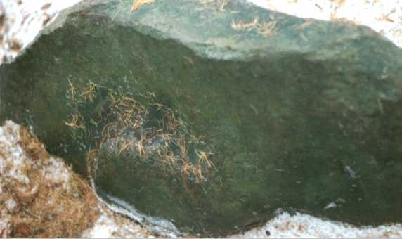
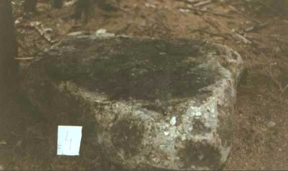
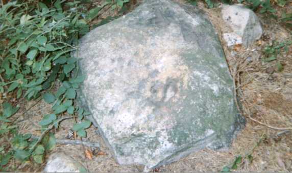
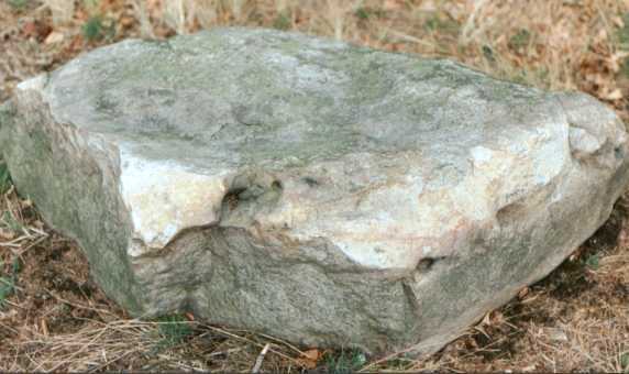
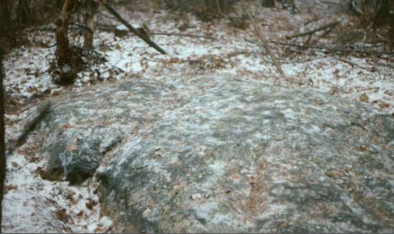
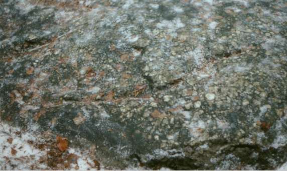
That quartzite that occur within Rovina (Plains) is very heterogeneous. Varieties are almost white, yellowish, orange up to meat-like brown. We also found a block that was light-greenish. Some of the color shades had been created though due to additional heat (glow)effects, but also the structure varie-s very much from fine-grained to coarse-grained or clusters. These lie on the spots just one besides each other. We suppose if quartzite was of local origin and formed within the same subsoil then it should show much more resemblance (similarity).
The survival of eructation throat of former explosive volcano Písečný vrch (318 m) is shoot up in the land register of the township Bečov (on the way from Louny to Most - the Bridge in Bohemia).
This Hill engaged of a primaeval man above all because whitish and yellowish quartzite crop out up the surface right here.
For their properties, they came in useful for the construction stony tools. Especially for it, they encouraged attention of the primaeval man long ago. Discovered tools, apices, scrapers, and arroy-heads much crusted. Local quartzite is from incipience of Quaternary. Is it possible that are stones on the Kounov from here? This reddish, yellowish and brownish ferrous quartzite is also in region Hořovice.
 |
 |
 |
 |
 |
 |
 |
 |
 |
 |
 |
 |
Let us admit that people had really managed to bring those stones over to here. What was their motivation to perform so hard? Such motivation should had been of some higher level that we are actually unable to find anymore within a modern society. The matter of cult (worship) had been of the utmost priority. In fact everything was subject to a cult and the value of human life was standing almost in opposition to that. We are virtually unable to see with the same eyes, either unfortunately, or luckily? The option of erecting a sacred grove seems to us as one of the acceptable hypotheses. Primarily, that would explain and somehow justify as well a superhuman effort exerted to build such a structure. Admitting its purpose to be based on a cult, a question remains why individual rows stay away from each other at just those certain distances, and why they differ quite substantially within some sections. What rules had been hidden over here, had the placing of stones, appearing as if non-accidental, a practical significance of some kind? To preserve such a structure just to serve setting up basic calendar directions of Sun and Moon, seems too complex.
You cannot get along with the fact that today Gibbon is unable to be seen from Paegas due to superelevation, and in addition Gibbon would have to lie about eight meters further south so that direction of the sunrise during summer solstice could be maintained.
The banks of the Plain (Rovina) slide down substantially due to mining activity concerning arenaceous marl. Therefore we do not know what the situation had been at the time of using the structures. Since we neither know its approximate age we are unable to make any correction of computation for the then extreme sunrise. But as presumed, the sun for instance at a time of 2000 B.C. during its winter solstice should had have risen two sun discs further to the north. To watch at the horizon (horizontal view) within the Plain must had been wonderful because of no forests then.
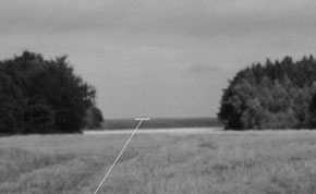
Small groups of stones located outside the rows themselves are pointing to a rather interesting direction as well (Beltine, Lugnasad?). From such a group lying within educational path, at its turning to a southern slope, there, at the length of a plain towards Filipov, is a nice view of a nearby oblong knoll (hillside) in the center of which you can see the top of Říp mountain.
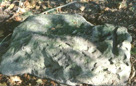
Another way determined stone 220 x 150 cm. Today lies disrupted already in derived position northeast of rows on limit field. For forestation is not verifiable course rise Sun about All Souls' Day. It is possible only suppose detects above right foothill jug.
Where are peoples interred? What ways of burial apply here? What say archaeologists? Could not dead man undergo cremation right on the rows necropolis? Glow different intensity incurred variety of colouring stones.
The Plain was not at that time forested. Were imperfect burned bones flip from limit gulch or they are below tombstone to date? Soil analysis could vouch or refutation scatters for increased contents phosphates. Take place in the Plain Watershed Ohře - Berounka and dead peak formed natural limits between tribes.
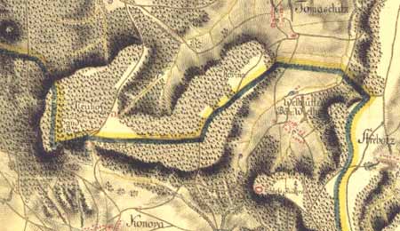
Is question, if stone rows leads only on Klucek, alternatively any farther namely and second towards Dzban and Zaly.
On known maps here goes through limits Rakovnik and Žatec.
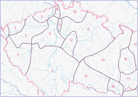
Layout tribes in period about 6.- 7. century with supposed limits
1. CHEBANÉ
2. SEDLČANÉ
3. LUČANÉ
4. CHODOVÉ
5. LEMUZI
6. ČECHOVÉ
7. DOUDLEBI
8. LITOMĚŘICI
9. PŠOVANÉ
10. MILČANÉ
11. CHARVÁTI
12. ZLIČANÉ
13. HORÁCI
14. PODYJŠTÍ MORAVANÉ
15. HOLASICI
16. HANÁCI
17.-18. MORAVŠTÍ SLOVÁCI
At present proceeds act about saving locality. Rows will modified and will take notice of basics about protection cultural memories. Among they Rows Kounov belongs to deservedly.


